

Tuxer Sonnenspitzen Express


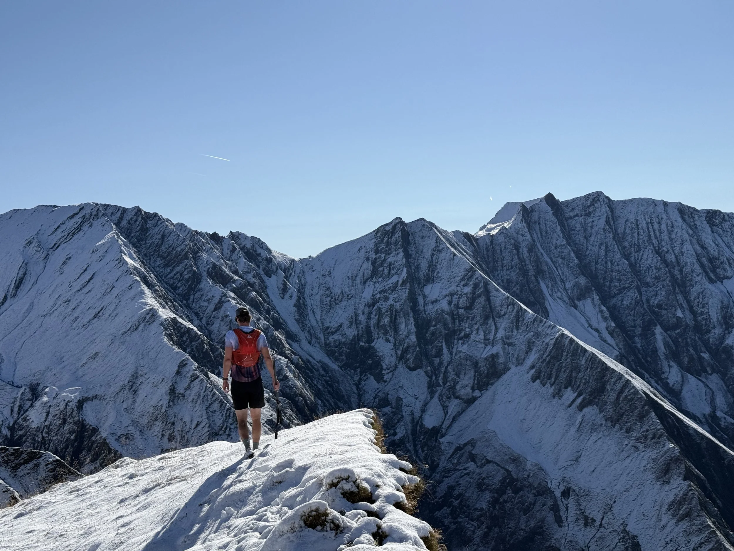

Technical difficulty: 7/10
Fitness: 9/10
Objective danger: 6/10 (with snow 8)
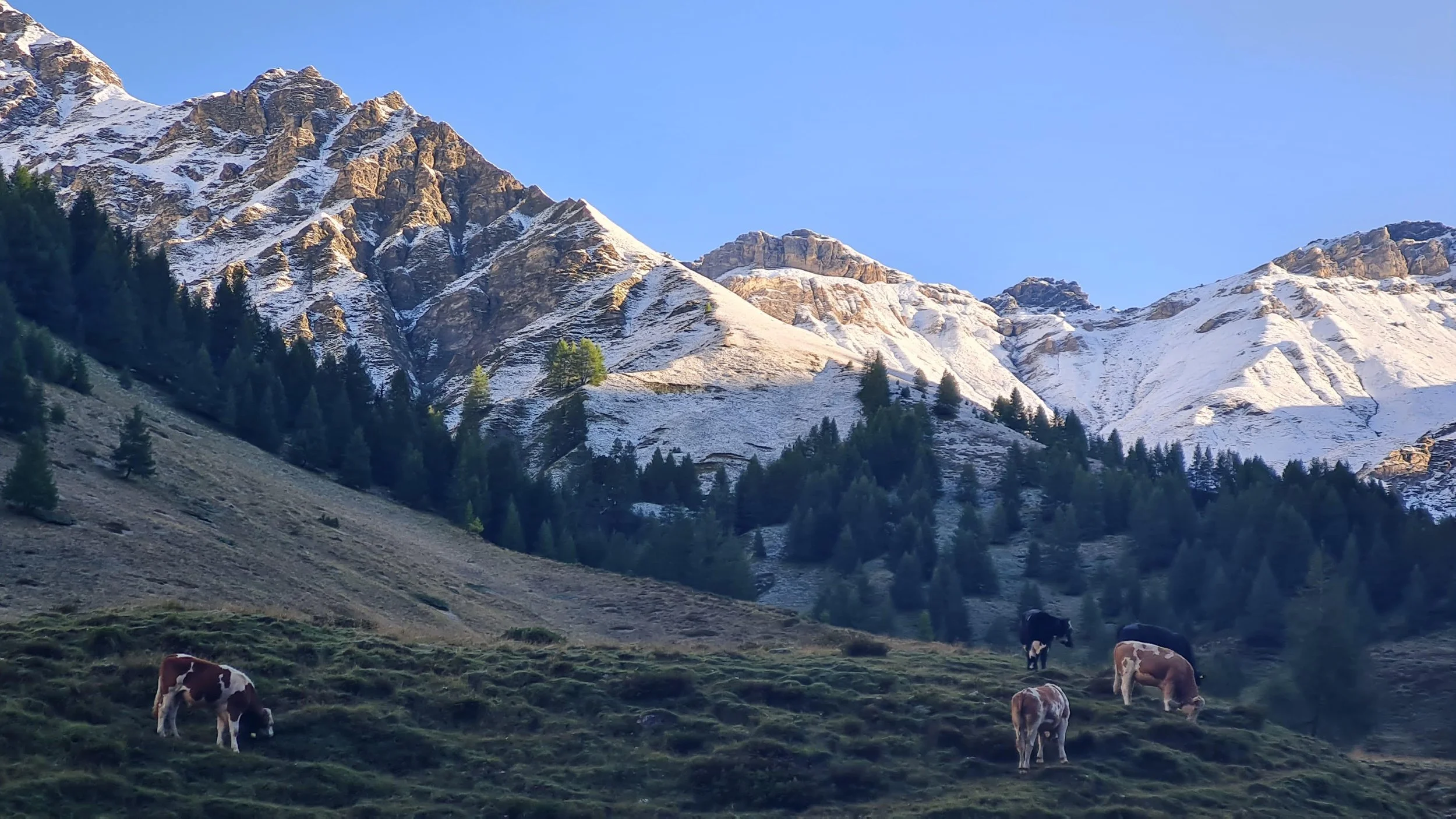
Landscape: 9/10
Busy: 2/10
A new route from the mind of Benni Brugger, connecting all the summits called “Sonnenspitze” in the Tuxer Alps. From Schirntal, through Lizumer Sonnenspitze, Mölser Sonnenspitze, Naviser Sonnenspitze a Sonnenspitze next to Glungetzer and down to Rinn.
Starting point: Schmirn Kasern (bus stop)
Ending point: Rinn (bus stop)
Length: 35km
Vertical: 2900m
Speed: Combination of technical trails with few runnable stretches.
Route:
We start of from the bus stop (or the parking lot) at the Ladins settlement at the end of the road in Schmirn valley. We start off through the Kluppe valley, on a forest road following the river towards Kluppenalm. Here a trail disconnects and starts climbing north, steeply uphill towards the ridge. We follow the trail until reaching the ridge to the right of Naviser Kreuzjochl. The summit is a short way to the left, we will continue to the right along the ridge (east). The trail follows the ridgeline before entering a large bowl next to Staffelsee (Staffel Lake). We climb out of the bowl to reach the saddle between the summits of Geier and Lizumer Reckner.
We drop down the other side of the saddle and descent through a large boulder field, before slowly ascending back up towards the summit of Lizumer Sonnenspitze (2831m). We follow the western ridge from the summit for a few hundred meters, before dropping into the north face of the mountain. In the beginning secured with fixed cables, this is the most technical part of the route and is tricky in wet or snowy conditions. Once reaching the bottom, we continue along the ridge, always heading north-west-ish. We cross the summit of Tarntaler Kopf (2710m) and traverse the south-west flank of Klammspitzen (2516m) before reaching a service road of the Wattener Lizum military area.
We cross the road and follow the grassy ridge towards a well-visible summit cross of Mölser Sonnenspitze (2489m) - our second Sonnenspitze. A similar grassy ridge takes us on a swift descent connecting back to the service road we left a moment ago. Here is our moment to stretch the legs a bit and run on the road. It does not last long and as the road drops down from the ridge, we stay on it continuing on a trail again, towards our next summit.
The next summit is reachable by following the trail almost to the saddle at Naviser Jöchl. Shortly before reaching the saddle, a small trail follows the ridge back north-east for a few hundred meters towards the summit of Naviser Sonnenspitze (2620m). This summit has two summit crosses, one easily reachable and the other one with a short climbing section to the summit. Both are well worth tagging. From the summit, we retrace our steps on the ridge and after reaching the saddle, follow the downhill trail north into the Volder valley.
The trail gets increasingly runnable as we descent, turning from rocky to grassy to eventually becoming a forest road leading to Steinkasernalm. There are self-serve drinks available at this hut, so bring some coins if you are interested. When we are ready, we continue on the trail. It stops descending and starts slowly ascending on the west side of the valley. The trail is quite technical, but passing through some really incredible terrain. After a deceptively long time, it leads us all the way to the top of the cable car from Glungetzer ski resort. From here it is only about 300 vertical meters left to the summit of our last Sonnenspitze (2620m). We pass the Glungetzer Hütte just before reaching the summit cross.
It is all the way down from here. That does not mean it is fast. We continue follow the ridge north-west. The trail is first quite bouldery and for long stretches disappears completely and leaves us roaming the summit plateau following the GPS until just before reaching the summit of Neunerspitze. This is a very obvious summit and a good orientation point to make sure you are going the right way. The trail drops off to the right, leading north through the alpine shrub and continues descending until we reach the much bigger trail of Zirbenweg.
Here most of the technical difficulties are over. The trails lead us through our descent towards the Inn Valley. Sometimes following the forest roads, sometimes taking shortcuts between the turns. We pass Rinner Alm along the way, before the last stretch of steep trail leads us down towards the village of Rinn. We end at the main road in the village, which also has a bus stop to take us wherever we need to go next.
Photos by @bennibru and @the.running.nomad