

Exploring Arztal


Technical difficulty: 5/10
Fitness: 6/10
Objective danger: 3/10
Landscape: 8/10
Busy: 2/10
Beautiful landscape and some not too hard summits in one of the most quiet and untouched valleys in central Tyrol.
guess post by @bennibru.
Starting point: Parkplatz Hinterlarcher, Ellbögen
Ending point: Parkplatz Hinterlarcher, Ellbögen
Length: 21km
Vertical: 1800m
Speed: some pathless parts in the upper valley, few technical passages on the ridge, mostly quite runnable trails and forest road.
Route:
Southeast of Innsbruck, in the western part of the Tux Alps, lie three valleys – Viggartal, Arztal, and Voldertal – that remain largely untouched by tourism. With their idyllic, secluded valley heads, they offer peaceful retreats far removed from the hustle. Even though the Inntaler Höhenweg – particularly its more popular “7 Tuxer Summits” section – runs right along the crest connecting all three valleys, it’s probably the lack of higher-altitude huts with overnight accommodation that helps preserve their original and quiet character. This route focuses on the Arztal and links several high, yet technically moderate summits at the back of the valley before following the northern ridge back down to the start.
We begin at the paid Hinterlarcher parking lot in Oberellbögen at just under 1400 m, accessible via a fully paved, though occasionally narrow, mountain road branching off from the Römerstraße. From the parking lot, we briefly follow the road to the last farmhouse and then take the forest road to the first left-hand switchback. There, passing a small chapel, we continue straight, ascending through forest trails. We soon rejoin the forest road and, near a supply cableway, follow a trail signposted toward the Arztaler Alm. The path now leads more openly and gently uphill across grassy pastures.
We pass the private Arztalhütte, and shortly after, before reaching the serviced Arztaler Alm, we turn right and head up the center of the valley through vast alpine rose meadows, gradually turning toward the right (southern) side of the valley. (Note: A longer variant of this loop via the Pfoner Ochsenalm and Kreuzjöchl is possible here.) Traversing the slopes below the Pfoner Kreuzjöchl, we pass a short rocky section to reach the flat cirque of the upper Arztalalm pastures, where we’re often greeted by peacefully grazing Haflinger horses. From here, we turn slightly southwest. The trail marked on the map across Seeblesboden to the Seeblesspitze is barely visible, so we follow sparse markings and scattered cairns – attentiveness or at least a preloaded GPS track is highly recommended. After the first steep section, we pass a small mountain lake; the final climb to the saddle becomes steeper, passing several rock formations (known locally as Knappenlöcher). Toward the end of the climb, the trail becomes more defined again, and at the saddle below the Seeblesspitze, the path is clearly visible.
A short but steep detour leads to the summit of the Seeblesspitze (2628 m) – not technically difficult, and well worth it for the southern views alone.
Back at the saddle, we follow the ridge toward the Grünbergspitze (2790 m). This section is a bit rockier, with steep drops on the right (south) side, so we stay consistently to the left (north). After a brief climb, we reach the summit and turn north – now joining the Inntaler Höhenweg.
The next segment toward the slightly higher Rosenjoch is initially straightforward. After descending to the saddle, however, we face a short section of protected scrambling – the most technically demanding part of the route. This short, easy climb is over quickly, and we soon stand on the wide summit plateau of the Rosenjoch (2796 m), the highest point of the loop.
There is an option here to descend back into the Arztal, but with some time and energy left, we continue on to the Kreuzspitze (2746 m), from which we plan to begin our descent westward.
The final climb to Kreuzspitze is also somewhat rockier and steeper but poses no real difficulties. The views from here are especially rewarding, opening up across the Viggartal and Voldertal – we are now at the central high point of all three valleys mentioned at the beginning. It’s a spot that let’s us dream of untouched powder fields during the winter months. The route continues westward along the ridge. Before long, we descend leftward back into the Arztal, where the trail leads over rock slabs and boulders toward the Dürrensee. From this point, an ascent to the Dürrenseespitze is possible, but we skip it today. From here onward, the path becomes less obvious – requiring attention and careful navigation using sparse markings and cairns.
We remain along the southern flank of the Morgenkogel, moving west. The terrain becomes increasingly grassy and the trail clearer again. Eventually, we reach a small, lonely and beautifully situated hut with a water source – an ideal spot for a pause. Just after the hut, we face one final climb of about 100 vertical meters to the Überfallgründl, where a path branches off to the Morgenkogel to the right, across large boulders.
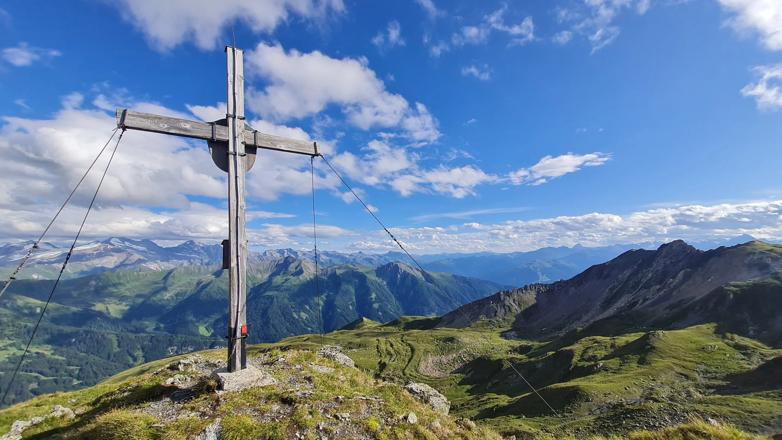
Instead, we stick to the ridge-like westwards – more of a back than a sharp ridge – and follow gently descending, enjoyable trails to the Morgenköpfl. We reach this summit, with its charming cross at 2216 m, from the "back side" via a small saddle. The Morgenköpfl is a fantastic viewpoint, especially toward the limestone peaks of the Kalkkögel across the valley. In the golden hour, the evening sun often creates magical moments here – a summit break is absolutely recommended.
The short, slightly more technical descent on the western side of the summit is followed by a very runnable, open trail. Unfortunately, this trail soon drops into forest, and we cross a forest road twice before reaching a junction at 1460 m. From here, we descend south via two switchbacks to the mountain road, which we follow gently uphill for a few hundred meters to return to the starting point and close the loop.
Photos by @bennibru and @the.running.nomad