

Technical trails in Stubai west


Technical difficulty: 8/10
Fitness: 9/10
Objective danger: 9/10
Landscape: 10/10
Busy: 1/10
Epic adventure on the west side of of Stubai valley. High passes, technical trails, exposed ridges and views from glaciers to steep walls of Kalkögel. Long day to remember.
Starting point: Falbeson
Ending point: Schlick 2000 ski resort (two cars, also doable with infrequent buses)
Length: 41 km
Vertical: 3200m
Speed: very technical trails. Maybe 10-15k where you can actually run.
Route:
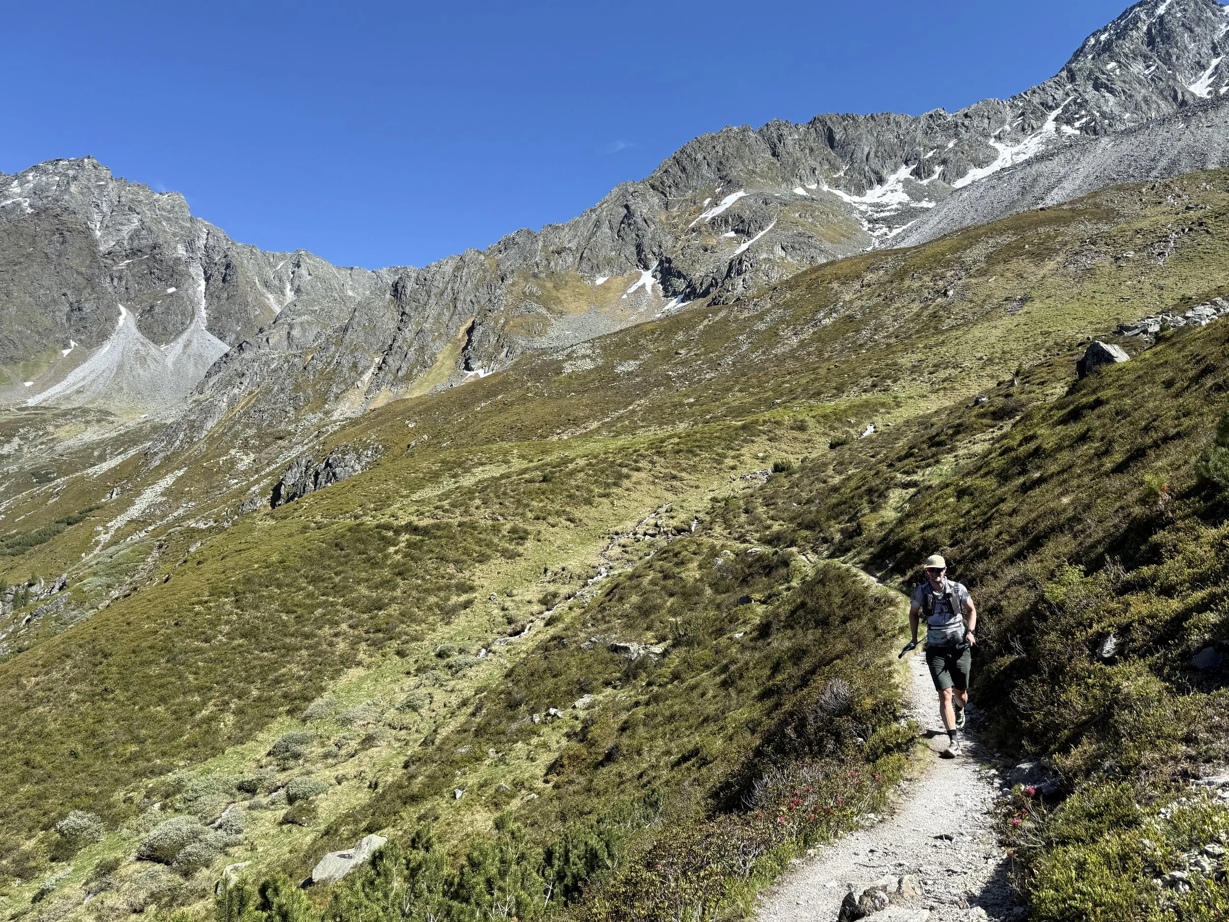
We start in Falbeson next to Hotel Waldcafe. Without any hesitation, the trail starts climbing from behind the hotel steeply into the forest north-westwards. In the beginning the views are pretty limited. We cross the service road a few times but stick to the trail until the forest thins and the valley opens in front of us. We join a flattening service road for the last few hundred meters before arriving to the Falbesoner Alm.
We continue through a broad valley, with iconically looking waterfall at the end of it clearly visible, and the Neue Regensburger Hütte perched on top of it. It is a very imposing view. The trail climbs gently through the valley, before getting steeper for the last bit before reaching the hut.
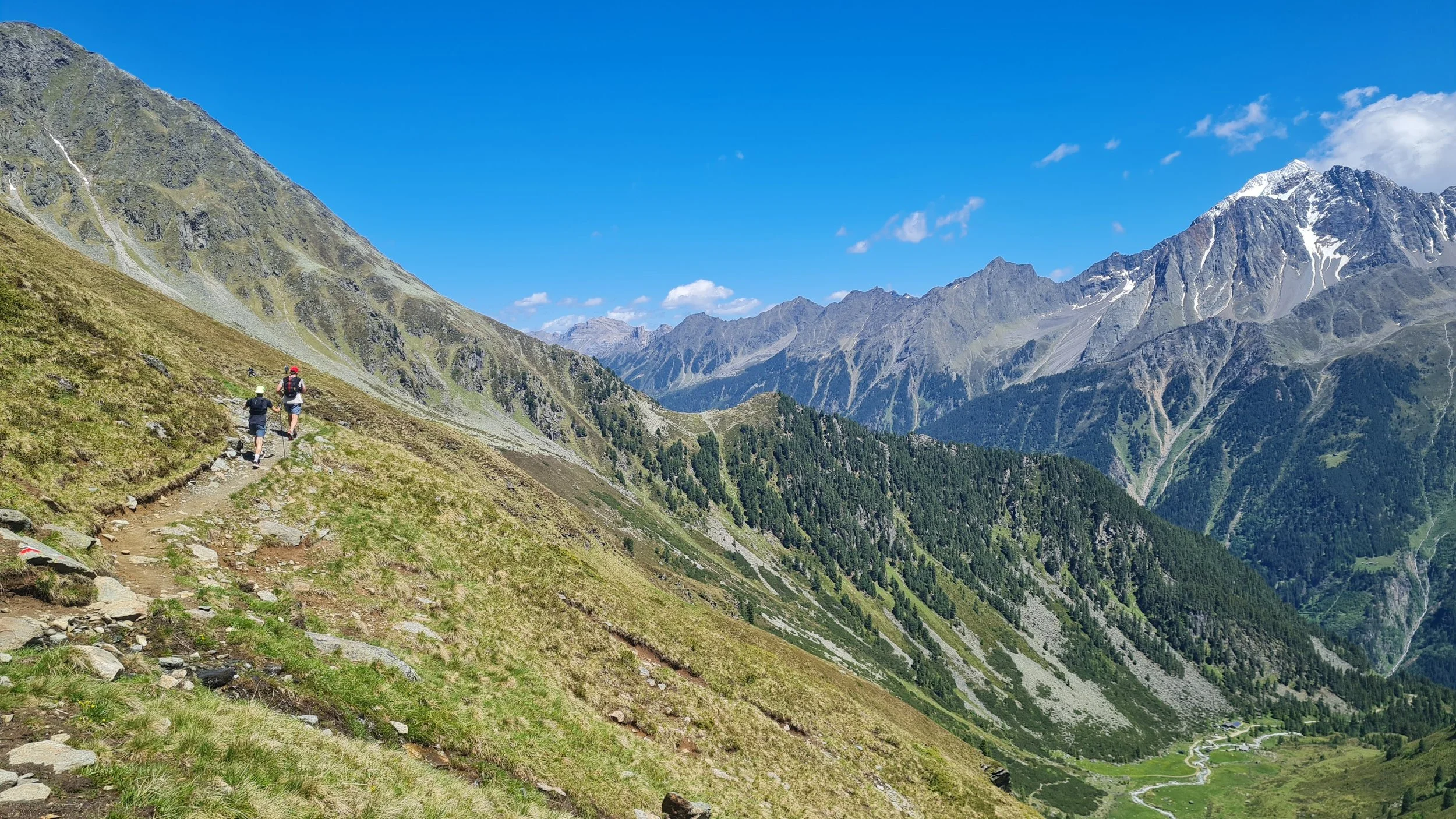
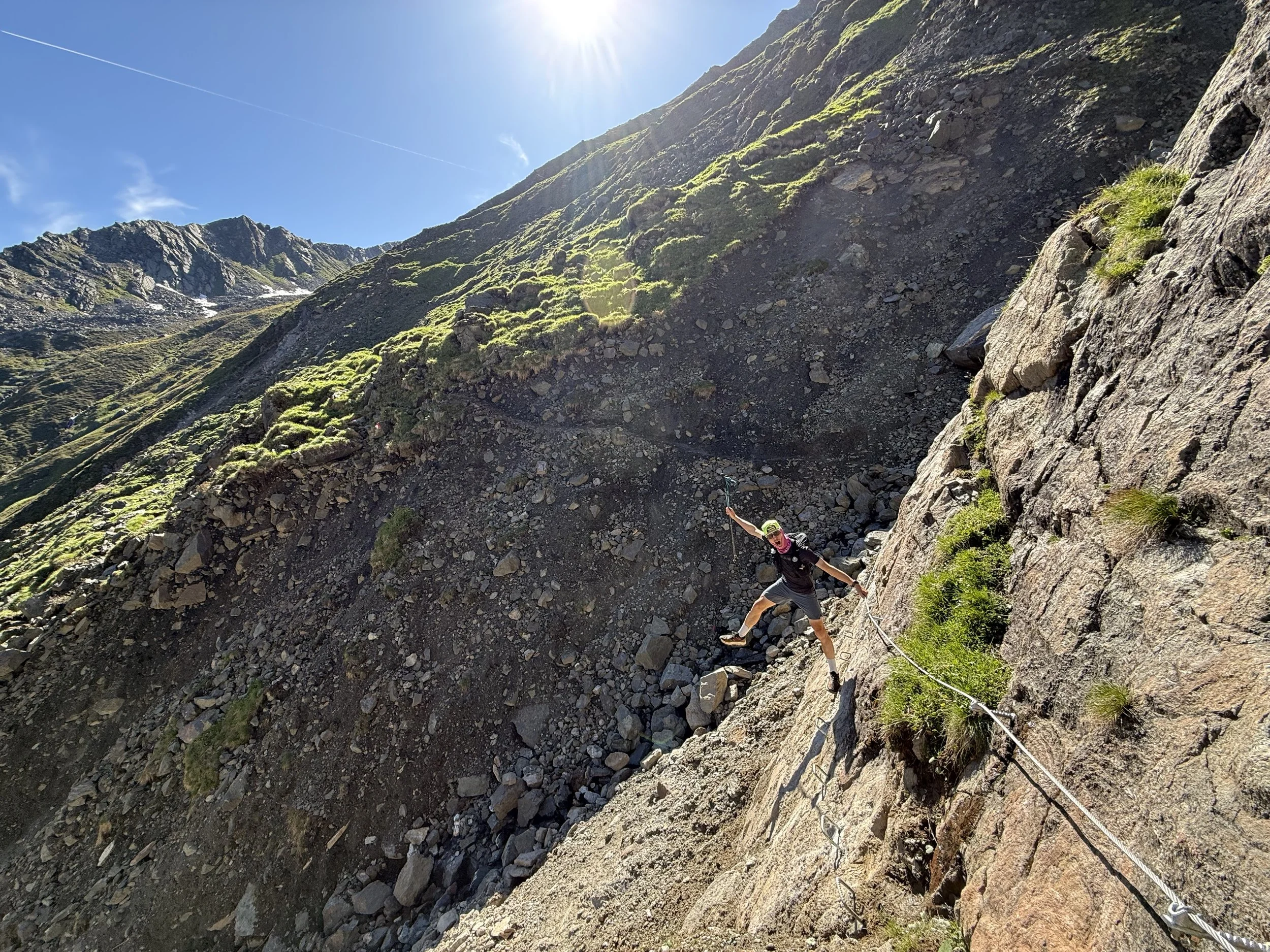
From here, we join Stubai High Trail for one stage towards the next hut along the way. We start by traversing north-eastwards along the flanks of the mountains, before turning of north and climbing steeply towards the pass at Basslerjoch. It is a very nice climb and only gets technical in the last few meters, with some fixed ropes making the way faster. On the other side, we enter a valley full of rock. First the trail leads us around a large bowl - Platzengrube - before starting the descent proper.
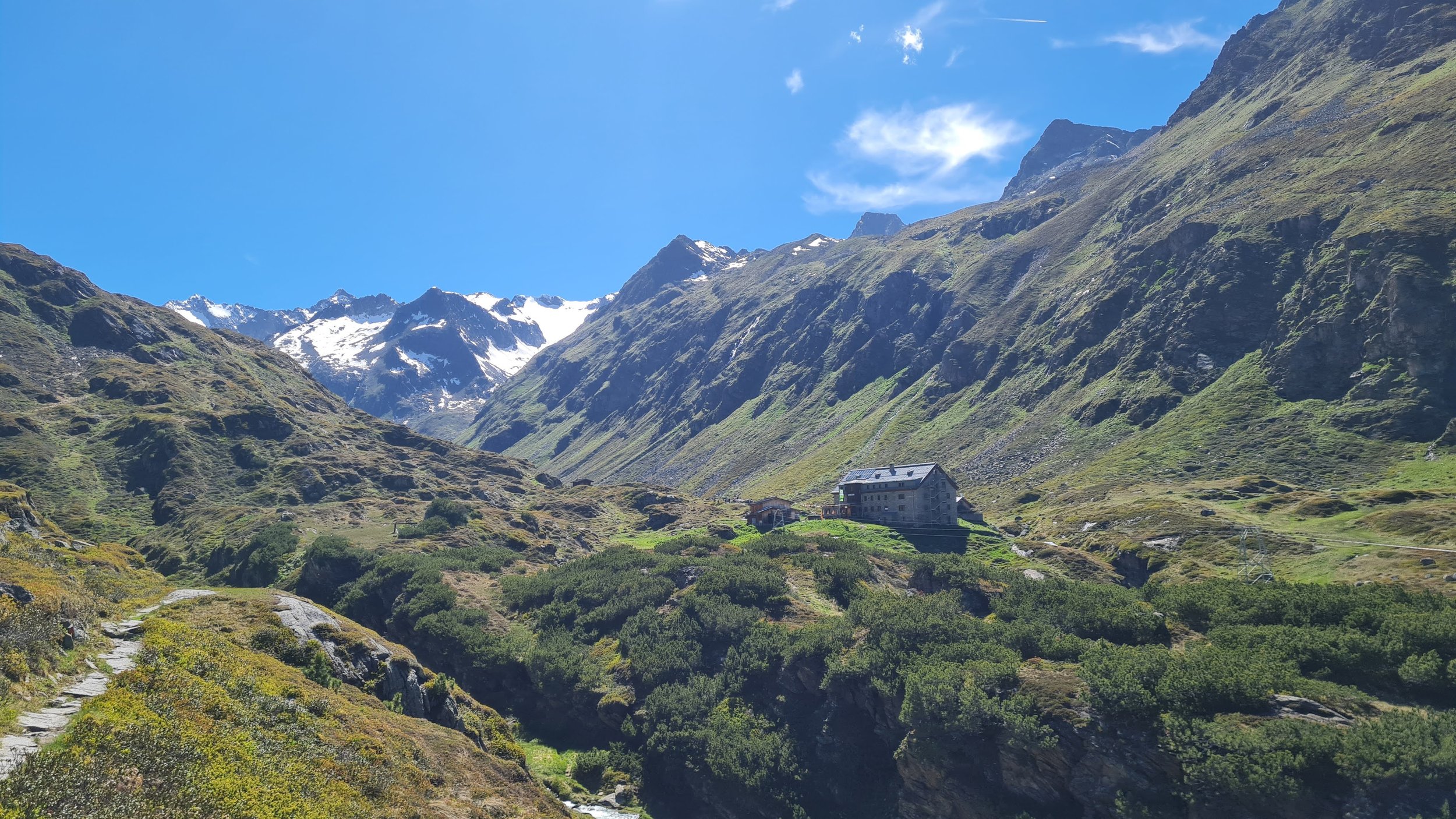
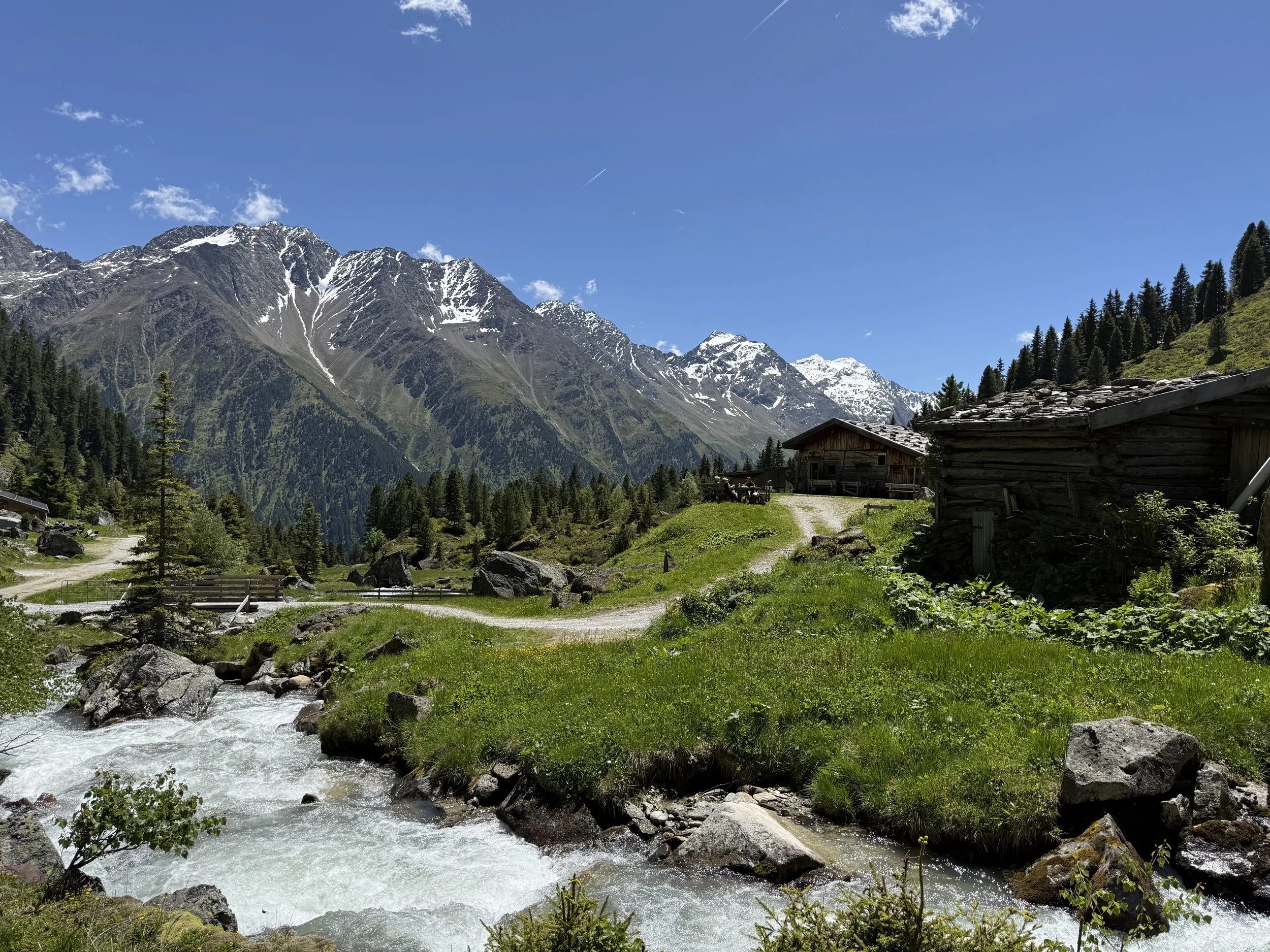
We move through a lot of exposed terrain, narrow trails with drop offs and a ton of boulder hopping traversing the mountain into the depths of Obernbergtal, with the relative civilization of Oberissalm visible below. So close and yet so far. After a lot of slow moving, the trail becomes a bit smoother and more runnable and eventually leads us to the Franz-Senn Hütte. Recommend stopping here for a break and even some food. There is a lot of hours of remote terrain in front of us.
We keep moving on the Stubai High Trail along a very technical trail. It is slow moving, with a lot of rolling hills and short steep uphills and very steep drop offs to the right. After what feels like a really long time, we reach the Seducker Hoch Alm - a private hut where our trail turns off. Highly recommend filling out water from the streams along the way before reaching the hut, there is absolutely nothing afterwards for at least 4 hours.
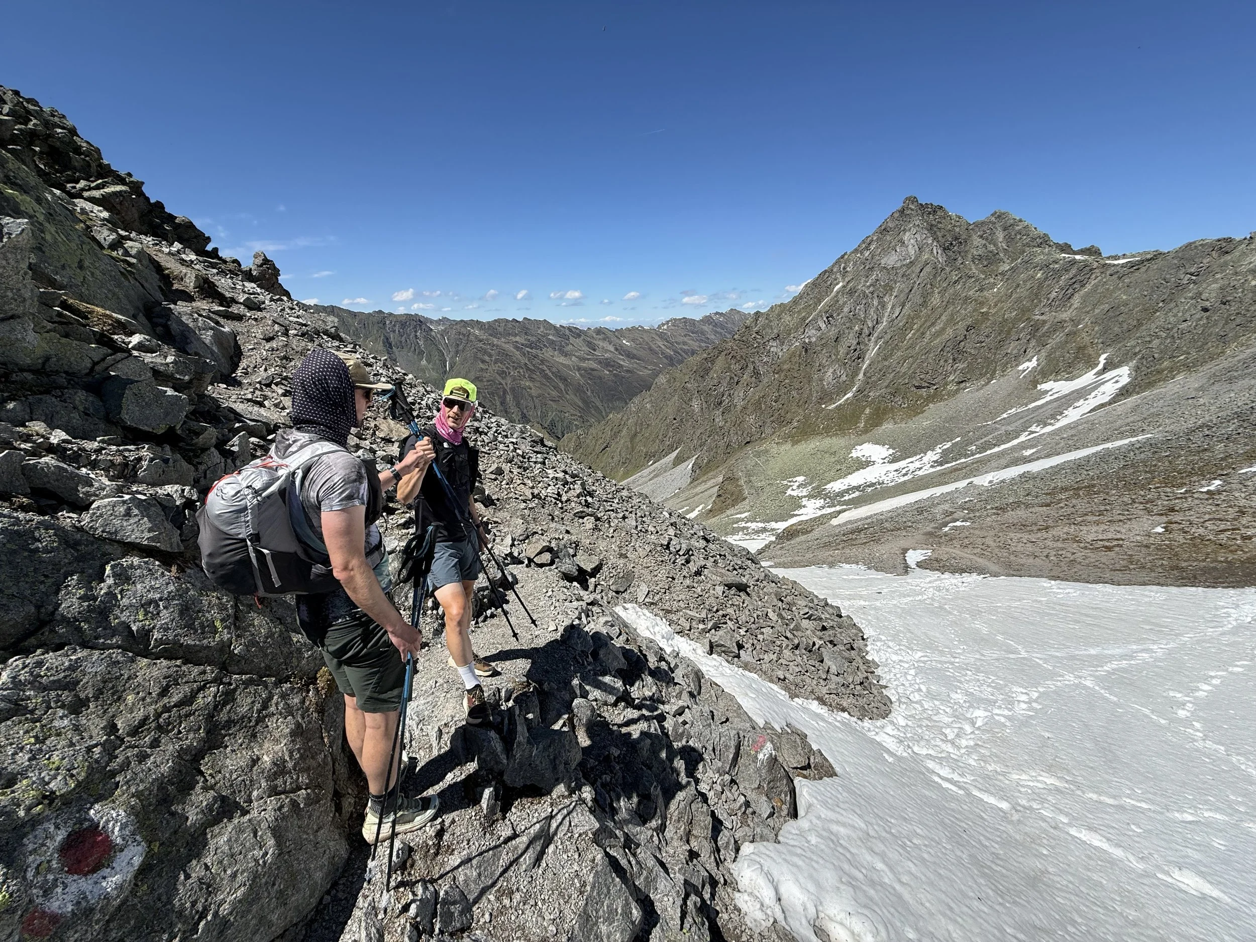
We turn off north-west from here on a faint steep trail, following the signs towards Wildkopfsscharte. The trail is sometimes hard to follow, but markings are well visible if you are looking for them. Once reaching the saddle, there is an optional side trip to the summit of Wildkopf (2719m). This is deceptively far and technical so check your time planning before committing to it.
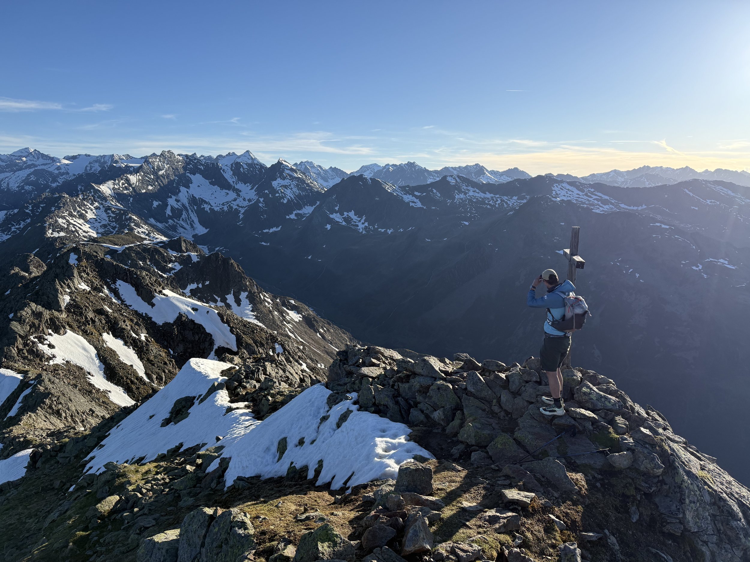
Our route continues north-east along the very technical ridge, very obvious and visible far ahead. The trail is very faint, there is a lot of scrambling and snow fields deceptively late into spring/summer. We cross the rocky summit of Schwarzhorn (2812m). From here, the trail is exposed but a lot more obvious and established. There is a lot of hoping around the ridge heading east. We can see the obvious ridge all in front of us with the striking ridge of Kalkögel in the background. The trail passes the summit of Marchsäule (2598m) and shortly afterwards rejoins the Stubai High Trail at the saddle of Sendersjöchl.
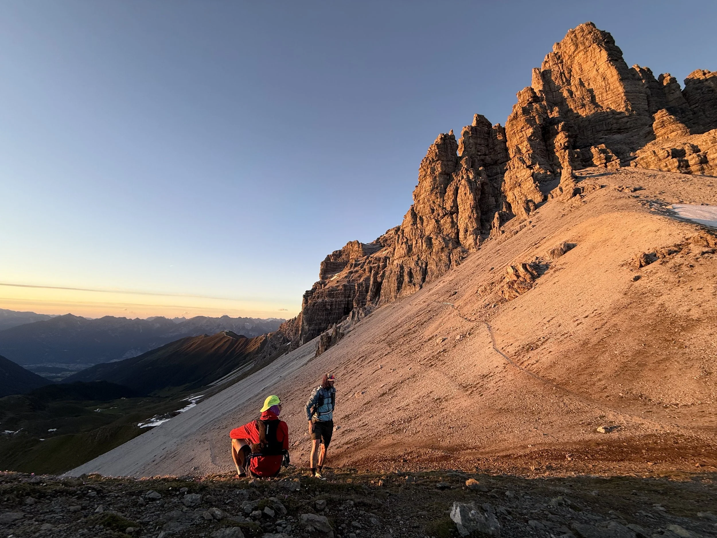
The trail is a jam from here on. We traverse under the summit of Steinkogel (2580m) on a beautiful runnable trail towards the rocky walls in front of us. We keep running until the saddle of Seejöchl just under the walls. The trail turns south-east here and traverses the scree fields of Kalkögel towards another saddle at Schicker Schartl. We flip over to the east side of the ridge and continue slowly traversing downwards towards another saddle under Burgstall.
From here, we turn west/south-west and ascend steeply through the scree. After passing a short rope-assisted section at the top, we pop up on the ridge and after only a few more meters reach the summit of Hoher Burgstall (2611m). We can enjoy a full 360 degree views from here with wide-variety of different sceneries. From glaciers to rocky walls to imposing ridges all around.
We backtrack our steps to the Burgstall saddle. Here all the technical sections are behind us and we can enjoy the very long and runnable downhill to the finish line. First we follow the very runnable ridge. We pass the top cable car station at Sennjoch. Afterwards, we follow the Panorama Trail on the left side of the ridge towards the top station of the Kreuzjochbahn cable car. There is another restaurant here if you are early enough for it to still be open.
We take the trail behind the hut and keep descending on a steep but runnable trail north-east under the cable car before reaching another hut at Galtalm. From here the way down is just a combination of forest roads and running down the ski slopes. The only interesting distraction is the Ruchen Weg with its chain of slides heading downhill, which can provide some relief for the legs and frankly, some fun :).
Eventually the slopes spit us out at the valley station of the Schlick 2000 ski resort and its parking lot.
Photos by @the.running.nomad, @bennibru and @joshuaschink