

The Unnutz Round

Technical difficulty: 4/10
Fitness: 6/10
Objective danger: 7/10
Landscape: 7/10
Busy: 1/10
Surprisingly varied and interesting loop in the Rofan mountains. Through ridges and canyons and all kinds of trails.
Starting point: Steinberg am Rofan
Ending point: Steinberg am Rofan
Length: 24 km
Vertical: 1650m
Speed: a lot of runnable trails. The section through the gorge is narrow and exposed.
Route:
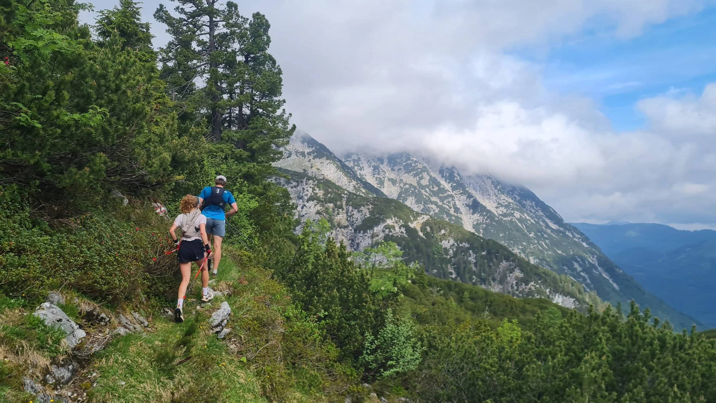
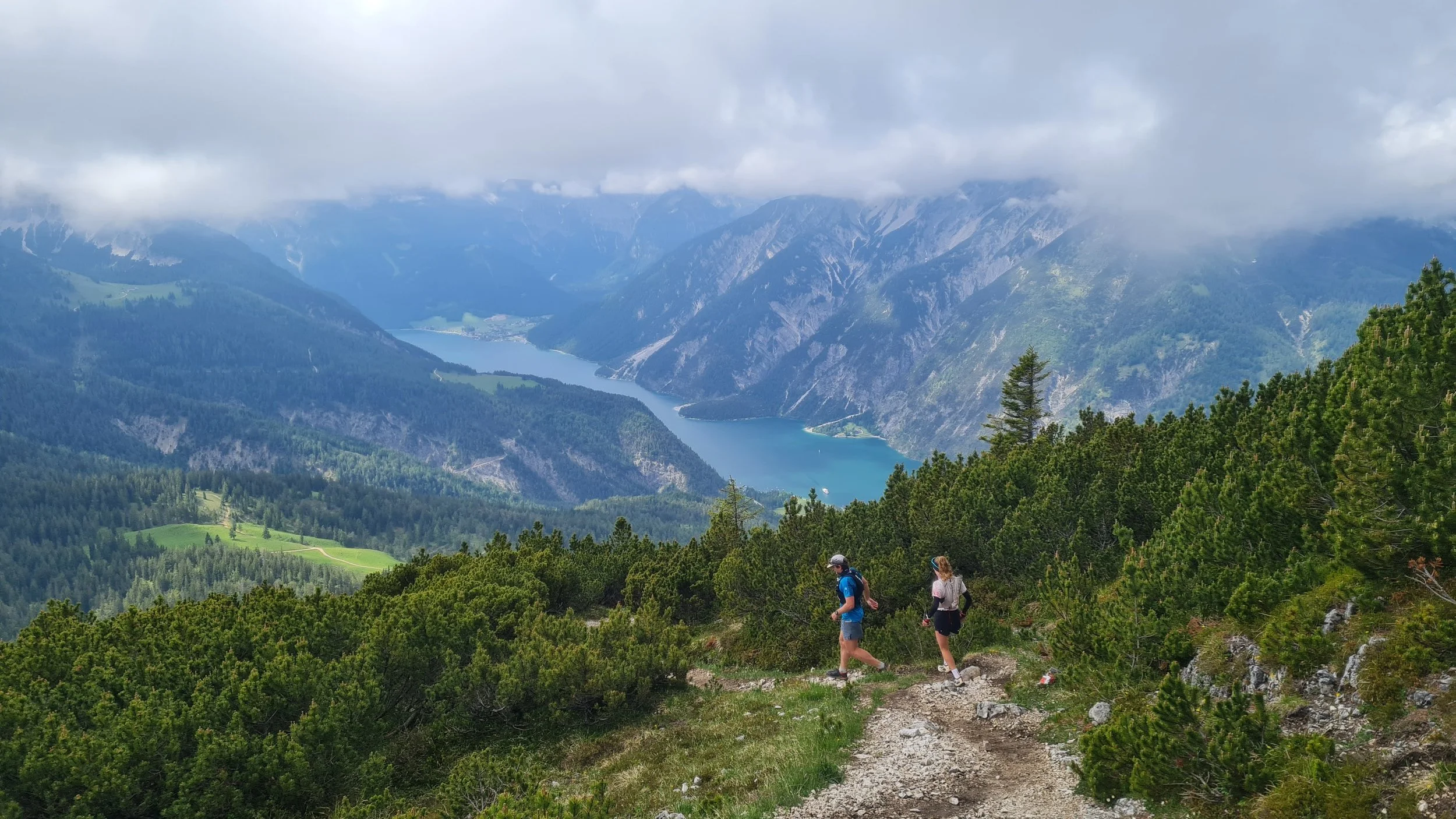
We start from the parking lot at the ski lift in Steinberg am Rofan, following the road north-west. After about 200m, a trail veers off to the left and start climbing up through the forest on a small trail. It varies between steeper sections and a short rolling traverses along the mountain sides, always following the general direction west/north-west. After a few hundred vertical meters, we leave the forest and get into a lower alpine shrub, still ascending higher and higher.
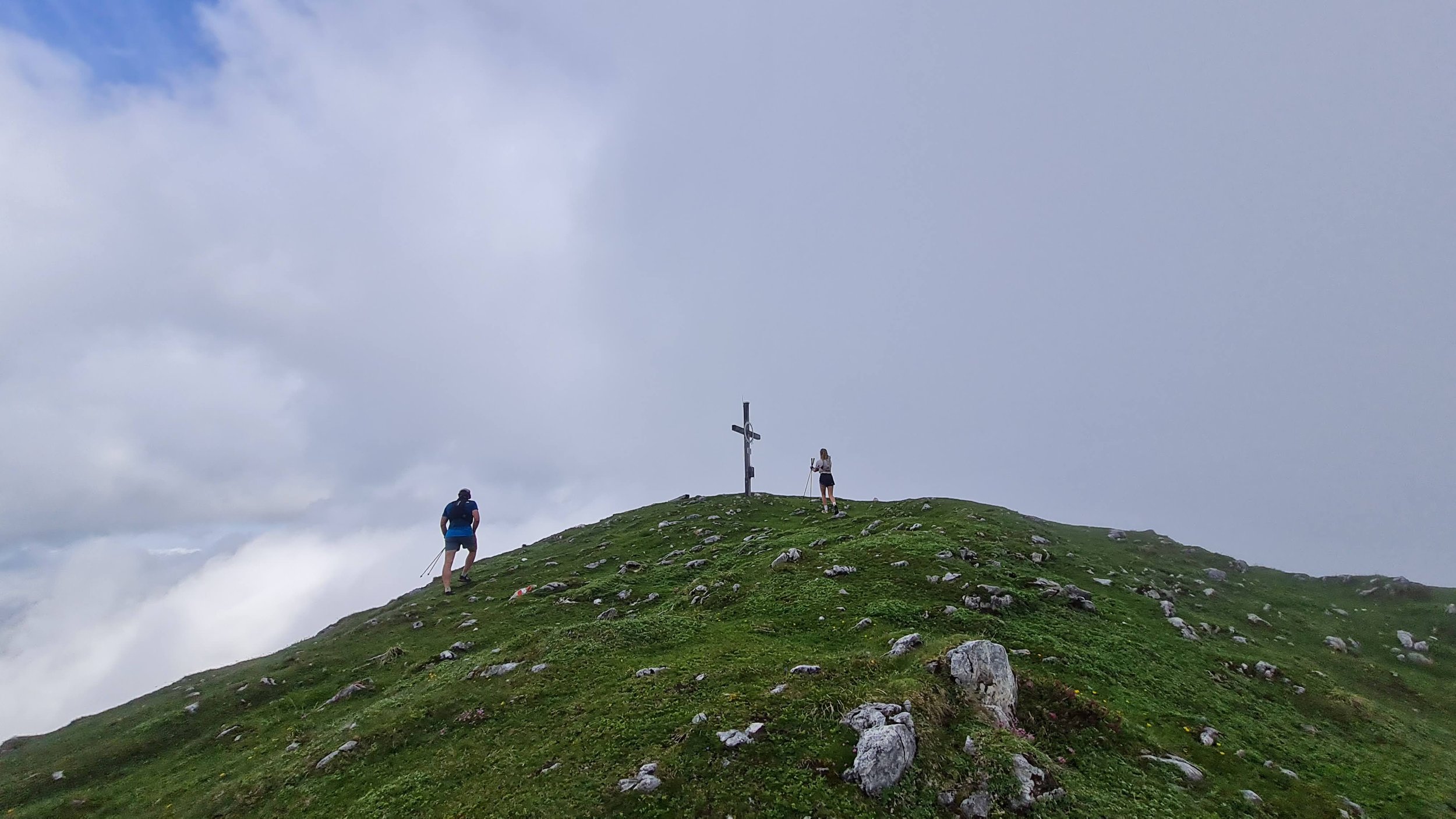
We keep climbing, enjoying the views back at the village and a rocky summit of Guffert behind us and Rofan mountains to the south. The alpine shrub keeps thinning further, until we reach the alpine meadows close to the summit ridge and after a few more vertical meters reach the summit cross at the top of Vorderunnutz (2078m).
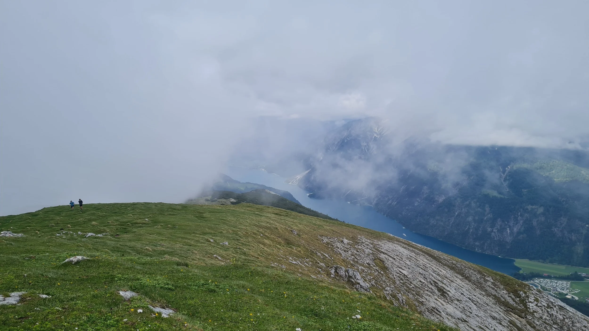
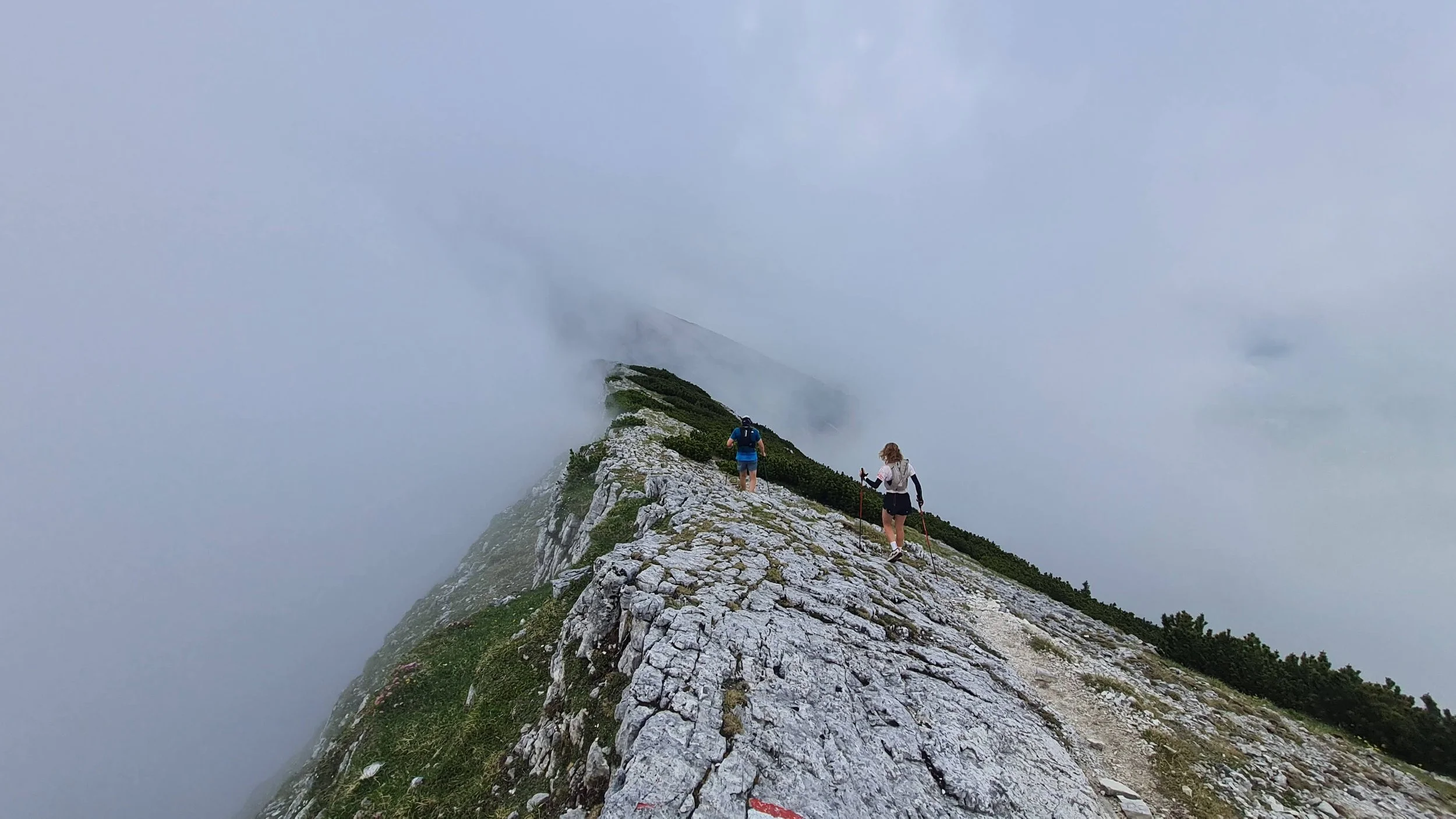
From here we do a bit of a back-and-forth along the ridge to the north. This section is optional and can be skipped. This is also the most technical section of the whole route. We descent a short bit from the summit north-east. The trail than continues traversing northwards on the east side of the ridge, before climbing back on the top of it and leading us shortly to the summit of Hochunnutz (2075m). From the summit, we retrace out steps back to the Vorderunnutz.
We continue further south, following the mountain ridge across a logical line back to the valley. Just before reaching Köglalm, we take a trail turning off and turning east towards Geismoosbach valley. A couple of hundred meters after reading a forest road, we take a forest road turning off south-east and get up a short climb over the ridge that takes us through one more valley to the south. Once the forest road gets over the pass, we descend a bit on the other side, passing by a private hut and continue further down on a faint trail towards the stream of Steinberger Ache.
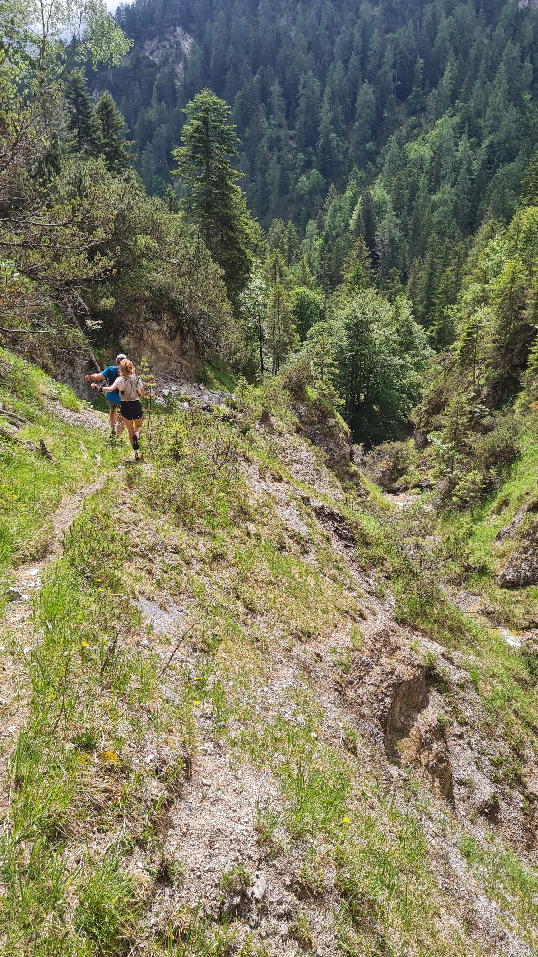
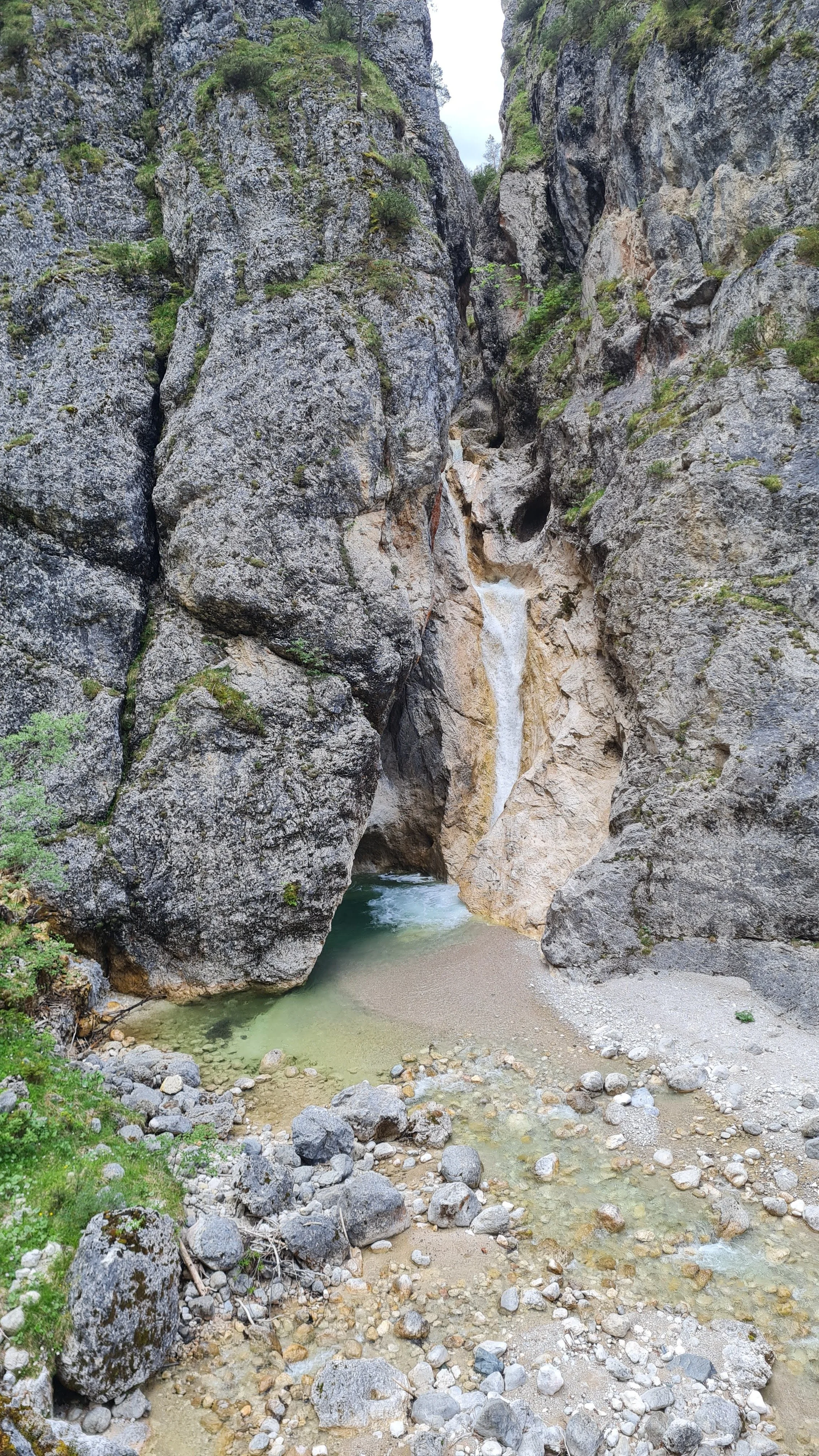
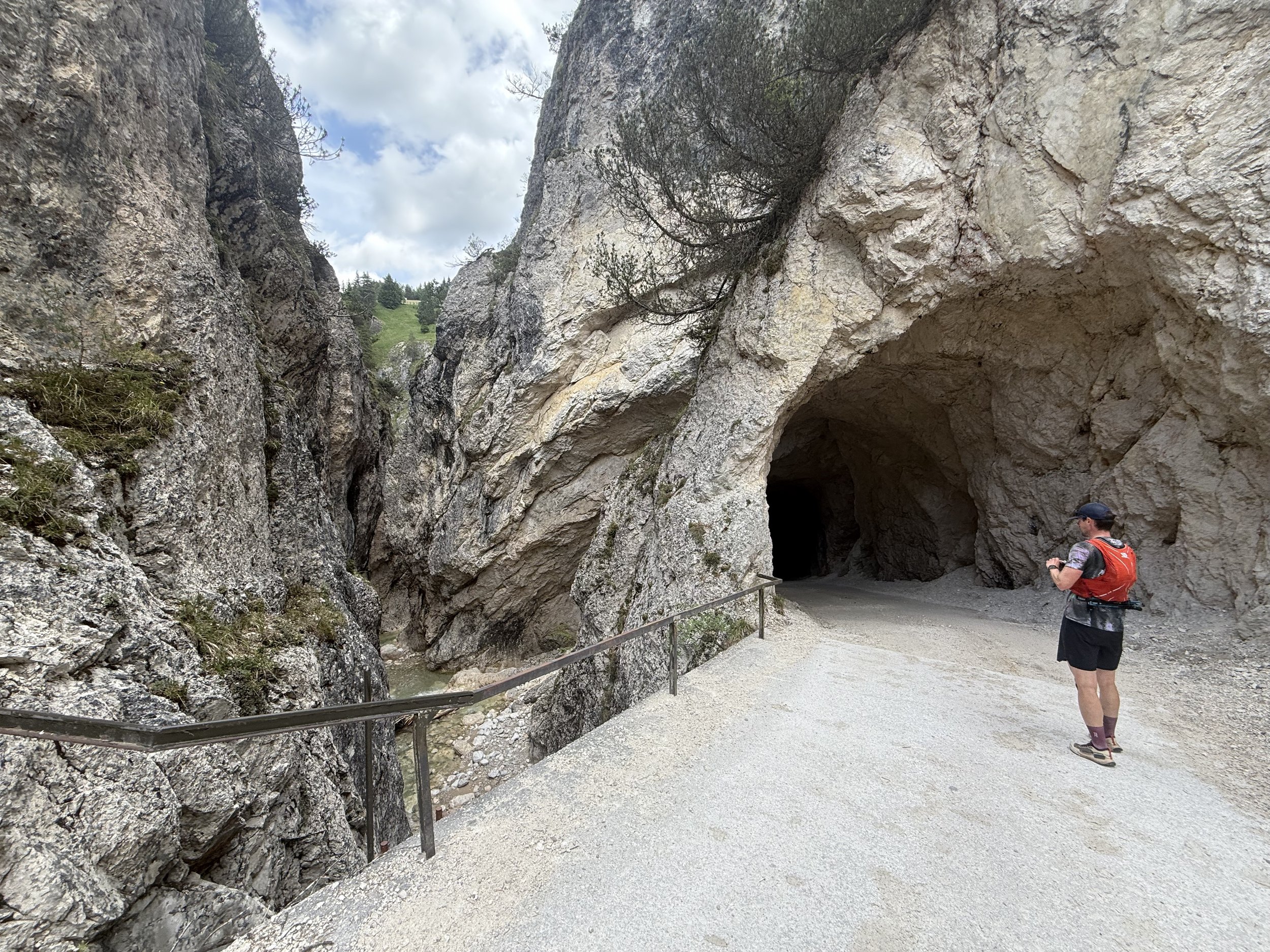
When we reach the river, we start following a faint and rarely visited trail following the left side (downstream) of the river through the gorge. It is at times very close to the river, at times climbs quite high above it. There are some quite exposed sections so watch your footing. The river has a lot of pools that look very inviting for swimming on a hot day. The river grows as we get further down the valley. The trail eventually connects to a forest road at a farm house. We continue downhill on the forest road, leading us east further down the valley. We pass through a tunnel and pass a two large waterfalls behind it, which also offer some nice places to swim.
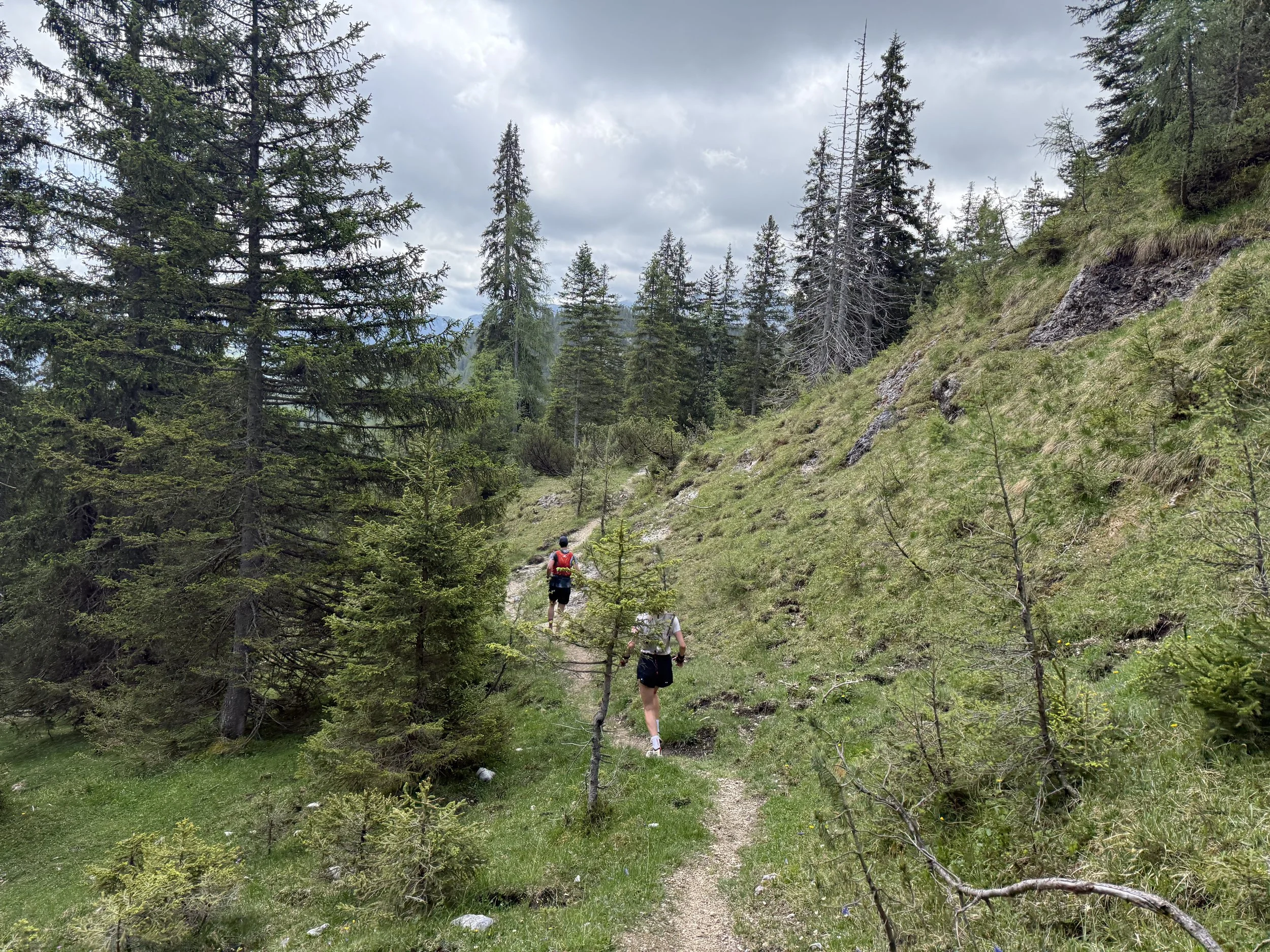
We run down this forest road, with some impressive rock falls around us, for a long time. Before running all the way back to Steinberg, we take a forest road turning off to the left and leading us up another gorge. It turns into a trail eventually and traverses northwards on a rolling trail back towards the houses and the parking lot.
Photos by @the.running.nomad, @bennibru and @isale04