

Lechtaler Höhenweg - Day 1


Technical difficulty: 8/10
Fitness: 10/10
Objective danger: 7/10
Landscape: 9/10
Busy: 4/10
The Lechtaler Höhenweg is considered a gem for mountain enthusiasts. It stretches over 80 kilometers along the main ridge of the Lechtal Alps. The route varies in elevation between 2,000 and 2,500 meters and is highly technical. This blog describes the first part of the route.
Starting point: Stuttgarter Hütte
Ending point: Steinsee Hütte
Length: 49km
Vertical: 3900m
Speed: Really slow technical trails.
Route:
This post describes the first day of our adventure on Lechtaler Höhenweg. The description on the second half is coming next week. You can split the route in any way you see fit (also in more days) and stay at any of the huts mentioned below. Huts require reservation!
Stage 1: Stuttgarter Hütte - Leutkircher Hütte
We start off by a short uphill to Erljoch followed by a long grassy downhill to the small farm at the bottom of the valley called Erla Alp. The views in front of us are immediately amazing. I will stop mentioning that as this will remain constant throughout the day. From the valley floor, we start ascending on a newly opened trail to a saddle, bypassing a landslide that destroyed the old trail, and then ascend through a long valley until we get to the ridge of Lechtal Alps. We will be following this ridge for the whole day. First we pass the Almajurjoch saddle and reach the Leutkircher Hütte.
Stage 2: Leutkircher Hütte - Kaiserjochhaus
This stage is relatively short and does not have a ton of elevation difference. We are following the ridge on the south side of the summits, mostly through grassy slopes with narrow technical trails. Just before the hut, we pass over a summit of Kaiserkopf and follow a short steep descent towards Kaiserjochhaus.
Stage 3: Kaiserjochhaus - Ansbacher Hütte
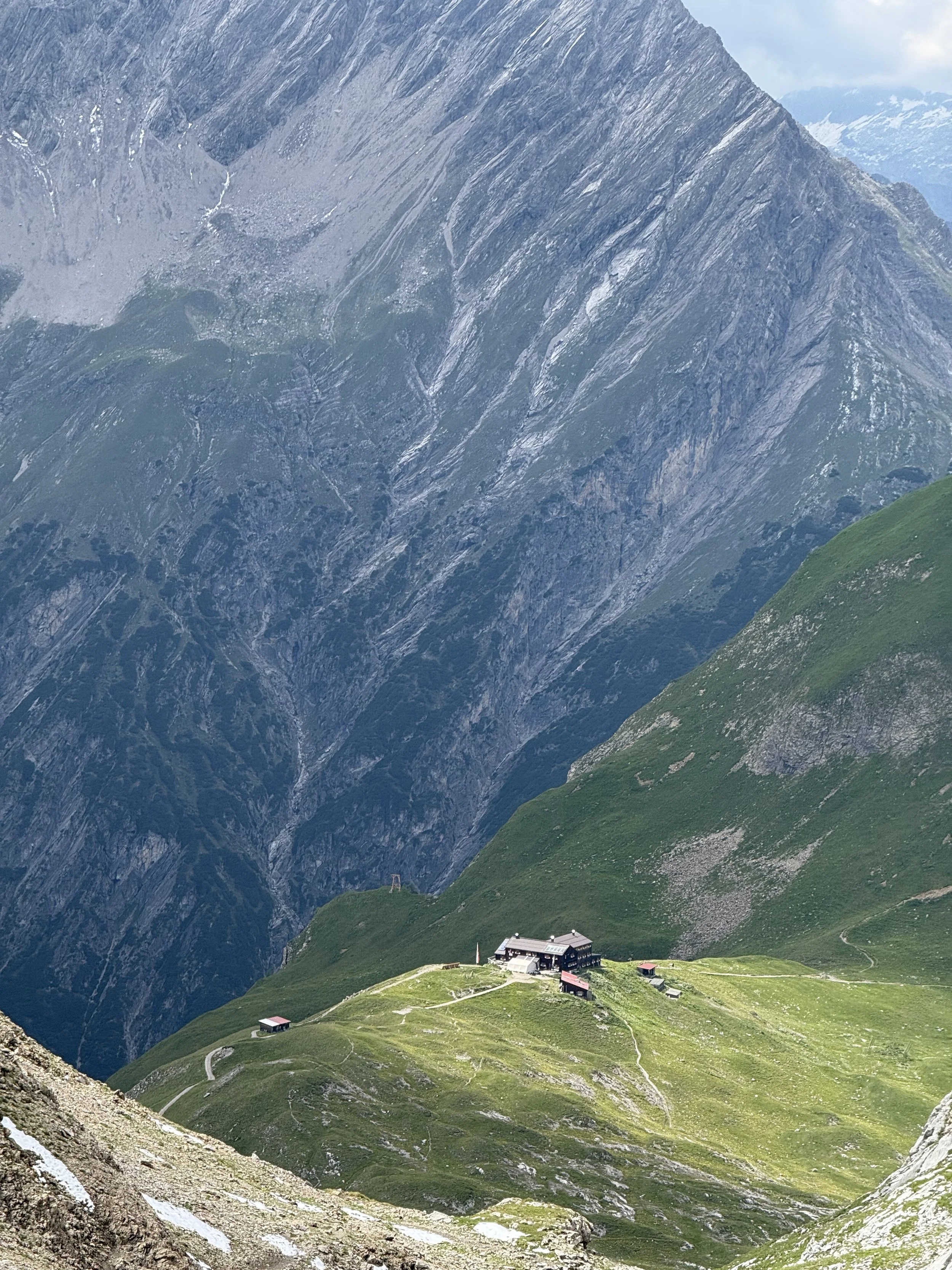
The trail starts getting a lot more challenging from here. First we traverse the south side of Grießkopf (2581m) and Kreuzkopf (2562) on rocky trails, before switching over to the northern side of the ridge, running above a beautifully blue Hintersee down in the valley. Then back to the south side, traversing the south flanks of Vorderseespitze (2889m) before ascending towards a pass at Flarschjoch (2464m). From here it is around 1km detour south to the Ansbacher Hütte. This was a half-way point (in distance, not time) for us, and highly recommended place for lunch.
Stage 4: Ansbacher Hütte - Memminger Hütte
The terrain continues to get more and more challenging (there is a theme here). We retrace our steps on the detour and continue follow the ridge line east. We cross on rocky trails over two passes - Winterjöchl and Grießlscharte - before following a long valley - Langkar - deep deep down to the valley floor. Eventually we reach the river at the bottom. What goes down, must go up. In that spirit, we follow a similarly steep grassy trails for some 700 vertical meters until we reach a plateau with a nice hut - Memminger Hütte -, amazing lake and a heard of Steinbocks grazing around.
Stage 5: Memminger Hütte - Württemberger Haus
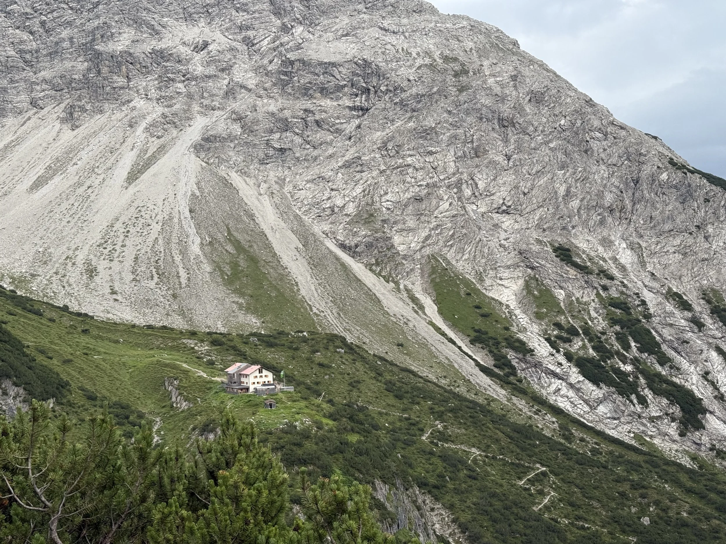
There is still a looong way to go. First we tackle the ascent up to the Seescharte. Passing by a valley full of lakes and scree. From here, the trail starts keeping true to the ridge more and more and crosses a few summits with some nice scrambling. We pass over Großbergjoch(2493m) and Großbergkopf (2610m), to reach the highest point on the whole trail at Großbergspitze (2635m). From the summit, we follow a steep descent with a ton of loose rock before enjoying the flow-y rocky trail traversing down towards the Württemberger Haus (newly renovated as of August 2025).
Stage 6: Württemberger Haus - Steinseehütte
It is not far to the end from here, but as the whole day, it takes a deceptively long time. First we ascend to the Gebäudjöchl (2452m) saddle. We follow a high traverse across rocky mountain-sides, before tackling the last big uphill of the day - Roßkarscharte. And it is worth it. Ascending few hundred meters through loose rocks, pulling on the fixed ropes. From the saddle, we have another short traverse to Steinkarscharte. From here, we can see the long final downhill to the Steinsee Hütte.
Photos by @bennibru and @the.running.nomad