

Weißspitze Round


Technical difficulty: 7/10
Fitness:7/10
Objective danger: 7/10
Landscape: 7/10
Busy: 3/10
A deceptively technical route in the vicinity of Sterzing, with plenty of rocky sections and amazing views of huge mountains all around.
Starting point: Parking on the way to Prantneralm
Ending point: Parking on the way to Prantneralm
Length: 28km
Vertical: 2500m
Speed: Very technical trails for the most part. The second half with some runnable parts on a forest road.
Route:
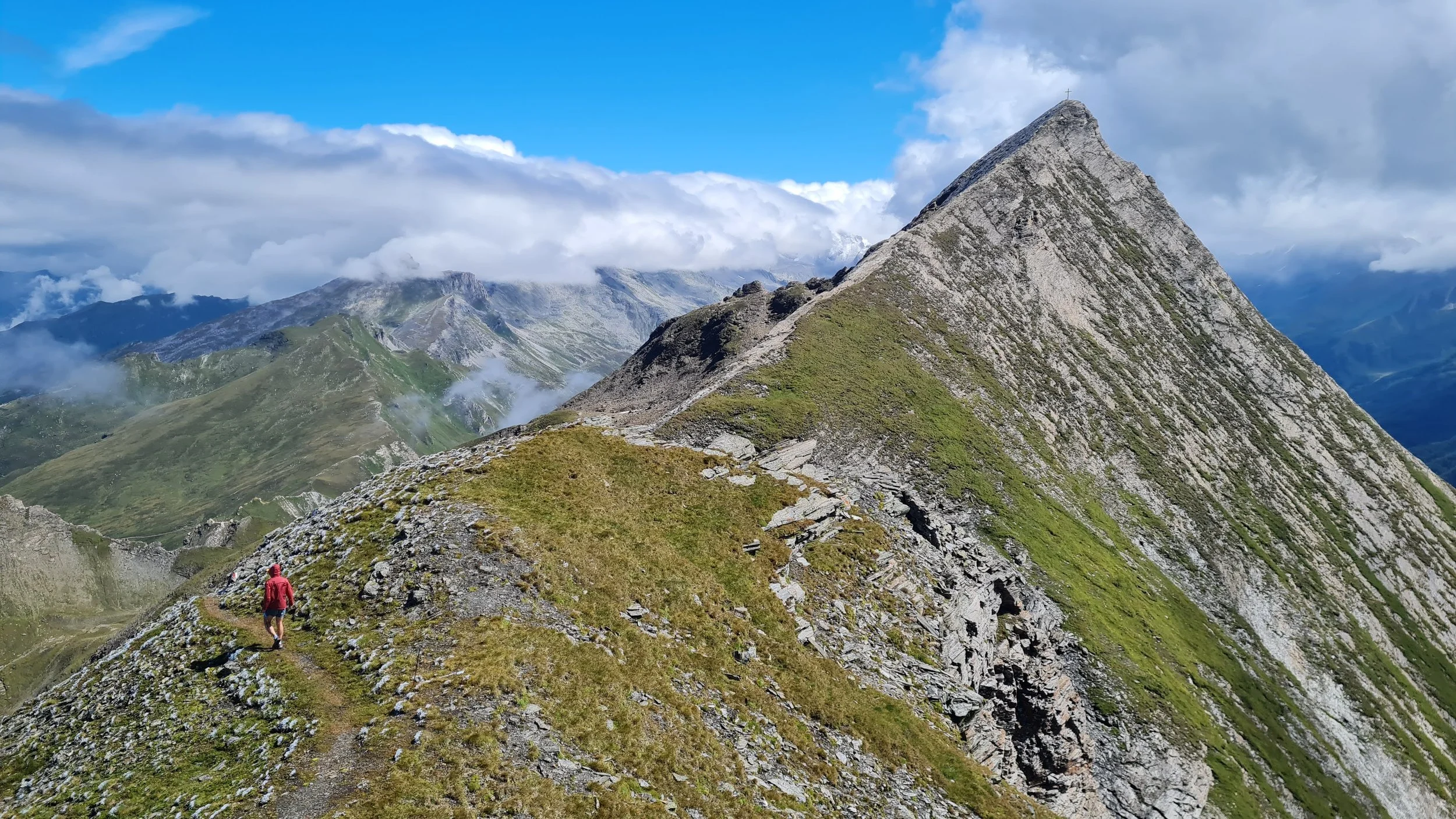
We start from the parking lot on a steep trail heading uphill eastwards through the forest. The forest slowly thins as we climb and eventually completely disappears, opening up into alpine meadows. After about 500 vertical meters, we reach the first summit cross at Saun (2085m). From here, we follow a broad grassy ridge (see pictures), following a cattle fence and continue climbing towards a rocky white summit in the distance. Along the way, we pass a summit of Riedspitze (2490m) and can enjoy beautiful views of Hochfeiler in the distance to the east.
Eventually we climb through a small rocky outcrop of white rock to the aptly names Weißspitze (2714m) - the white peak. The trail starts getting more technical here and follows a rocky travers towards an old NATO radar station. From here it is just a short rocky traverse along the ridge to the summit of Amthorspitze (2748m).
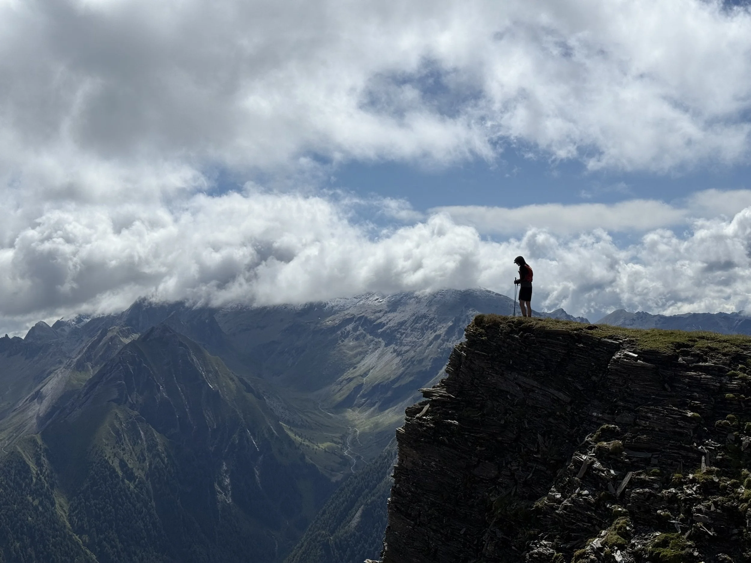
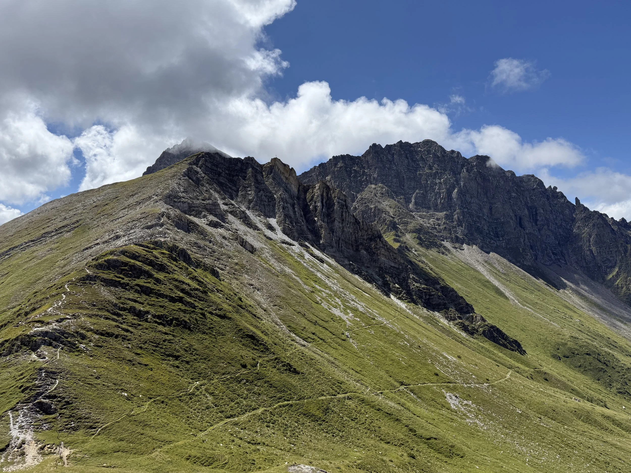
Here the most technical sections of the trail start. We follow a tricky ridge to the summit of Rollspitze (2800m). In bad weather, this can be really sketchy. The downhill does not get any easier. The trail has a ton of loose rocks and surprisingly tricky route finding at times (at least relative to what we are used to in Tirol). After following the ridge north for a bit, the trail starts descending through a really steep eastern flank into the valley. Once we reach the grassy areas again, the trail turns north-west again and traverses along the mountain side with only a short ascent to an interesting peak of Kalkwandspitze (2388m).
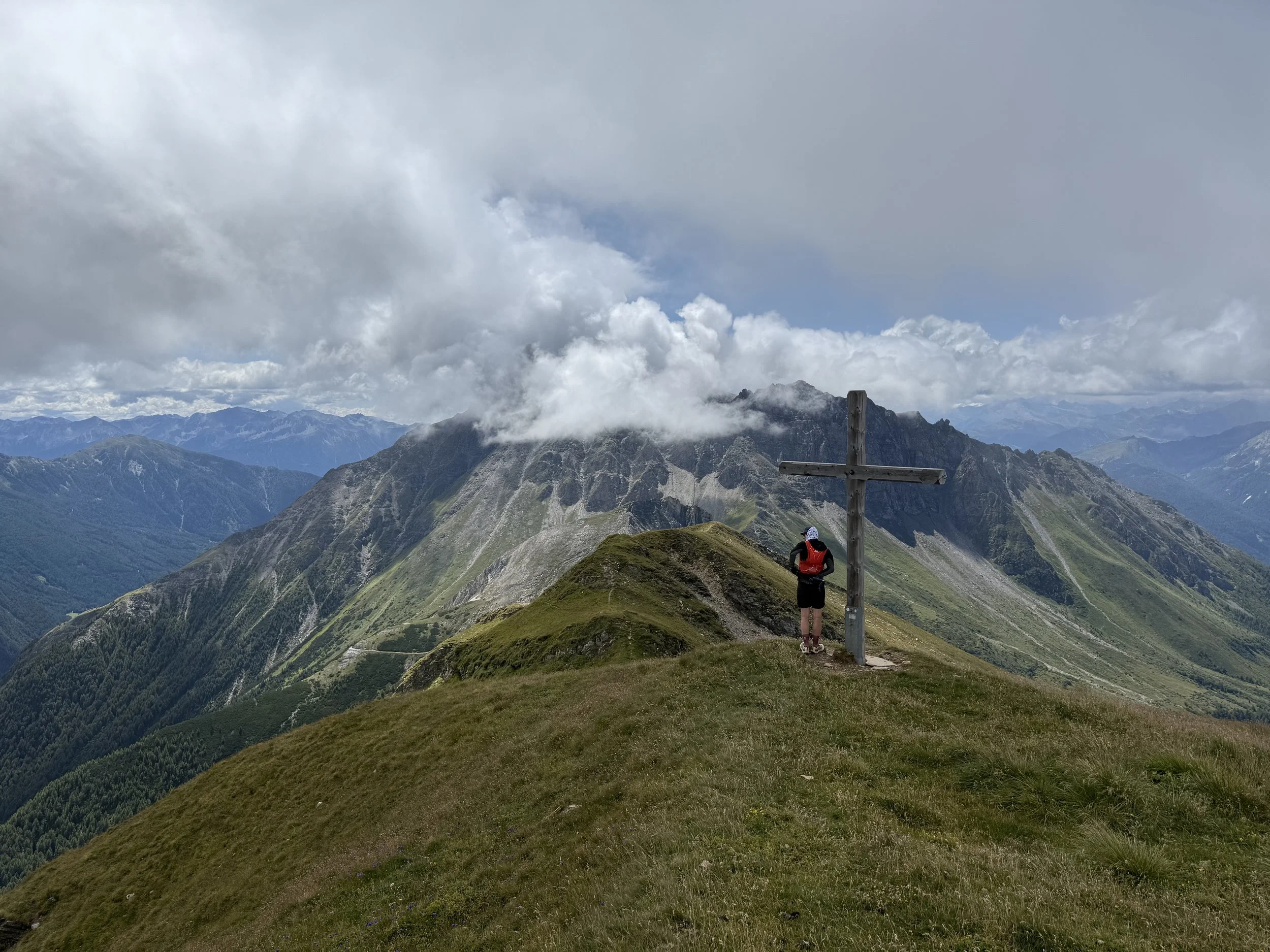
We cross over the summit and descent towards Schlüsseljoch saddle. Both Kalkwandspitze and Rollspitze look a lot more intimidating looking backwards at where we came from. We only have one summit left now. Still follow the ridge, now on a narrow grassy singletrack, we eventually reach the summit of Flatschspitze (2510m). We can see a cluster of houses down below to the south-west. This is our next goal.
We follow a very faint and surprisingly technical trail straight down towards the houses before eventually connecting to a forest road and finally enjoying a bit of faster running. There is a couple of huts along the forest road, where you can stop. Rigugio Genziana and further down the forest road also Riedl Hüsler Alm. After the second one, we are on a trail again.
Heading south-west, the trail is again quite narrow and technical, and while it mostly traverses the hillside, there is a surprising amount of elevation change on it. It feels a bit endless before finally smoothing out a bit just before it reaches the Hühnerspielhütte. From here we connect to a forest road and the running gets much faster.
The last few kilometers has plenty of huts along the way as well, in case you need/want them. Platzbergalm first, then Riedbergalm and finally Pratneralm, before finally reaching the parking lot again.
Photos by @the.running.nomad and @bennibru