

Wettersteinrunde


Technical difficulty: 4/10
Fitness: 6/10
Objective danger: 2/10
Landscape: 7/10
Busy: 6/10
A scenic loop starting in Leutasch with fast valley kilometers and a traverse of the southern flanks of the Wetterstein range.
guest post by @bennibru
Starting point: Leutasch Kirchplatzl
Ending point: Leutasch Kirchplatzl
Length: 30km
Vertical: 1500m
Speed: fast and rolling KMs in the valley, trails are quite flowy but can be slow and muddy after rainfall
Route:
We start our loop at the Leutasch district named Kirchplatzl, heading southwest. The first kilometers are flat and take us through the districts of Plaik and Klamm, then into the Gaistal valley. We begin on the wide hiking path on the left side of the Leutascher Ache, heading gently uphill. On the opposite side of the valley, a road also leads in, which we use only briefly near the point where a trail branches off to the Kalvarienberg on the left.
At the Salzbach parking area, we cross the river again and follow the wide Ganghoferweg. Despite several short climbs, this section – past the Gaistalalm and onward to the Tilfussalm – flows smoothly and is generally shared with plenty of hikers and cyclists.
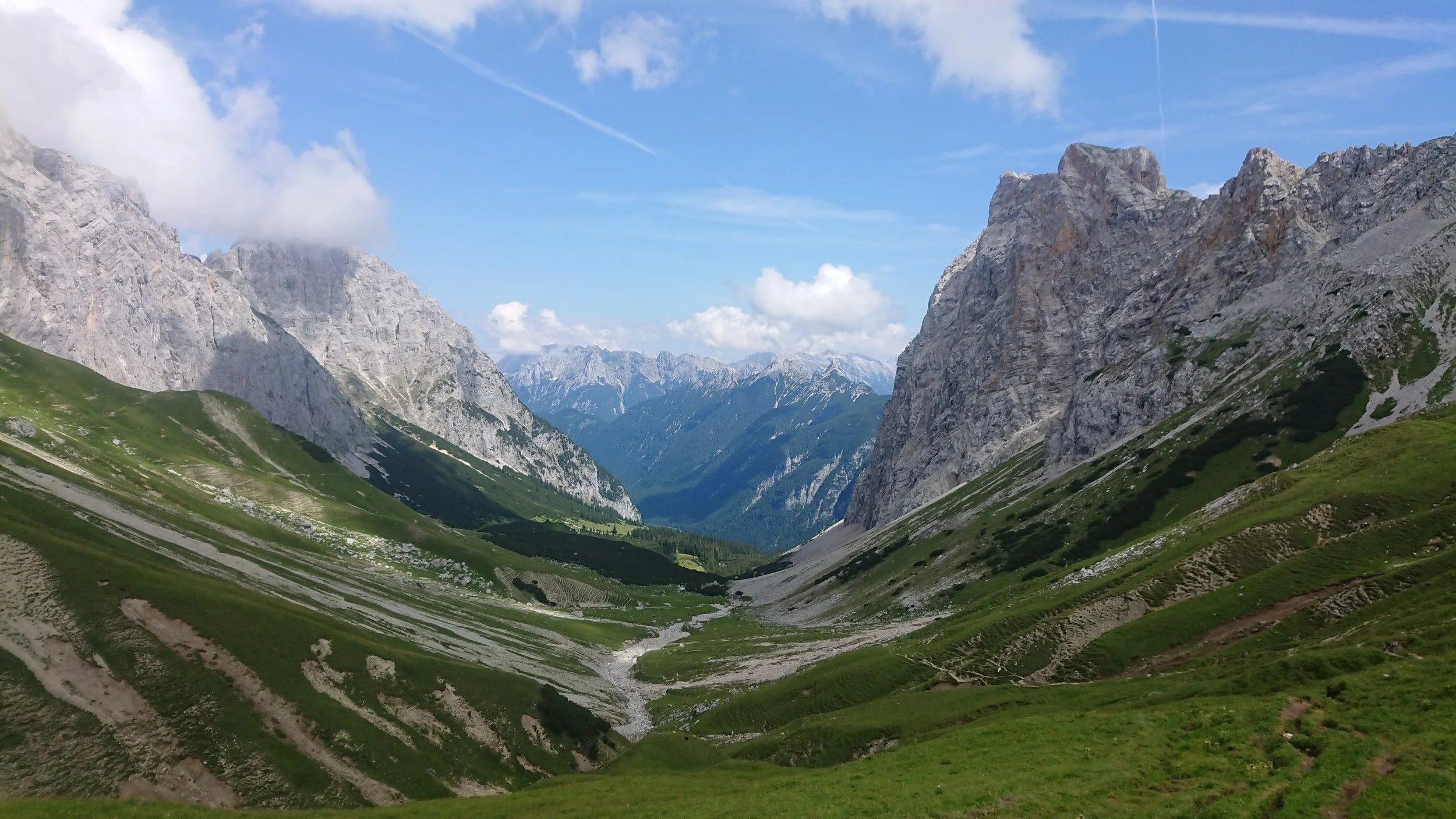
Right after the Tilfussalm, a trail leads us uphill through light forest and mountain pines toward the Steinernes Hüttl. This path crosses a mountain stream twice, offering good chances to refill water. After reaching the Steinernes Hüttl (there’s also a summit cross at a nice viewpoint) at around 1950 m, we curve right and follow the southern slopes of the range, gradually gaining more altitude. Over the next few kilometers, the trail offers magnificent views of the eastern Mieming Range, especially the Hohe Munde, as well as the Seefeld Plateau.
We arc toward the Predigstein summit but skip the top, instead taking a shortcut (partly off-trail) downhill toward the Rotmoosalm. Before reaching it, after a brief forest road segment, we watch for uphill trail traces to our left. Following the Südwandsteig (South Face Trail), we pass a lovely rest area. A long traverse follows – mostly flat, but across rockier terrain. Near the ridge below Plattach, we enjoy another panoramic spot, and after one final traverse, we reach the Scharnitzjoch. From here, a trail branches south to the prominent Gehrenspitze – definitely worth coming back for a visit.
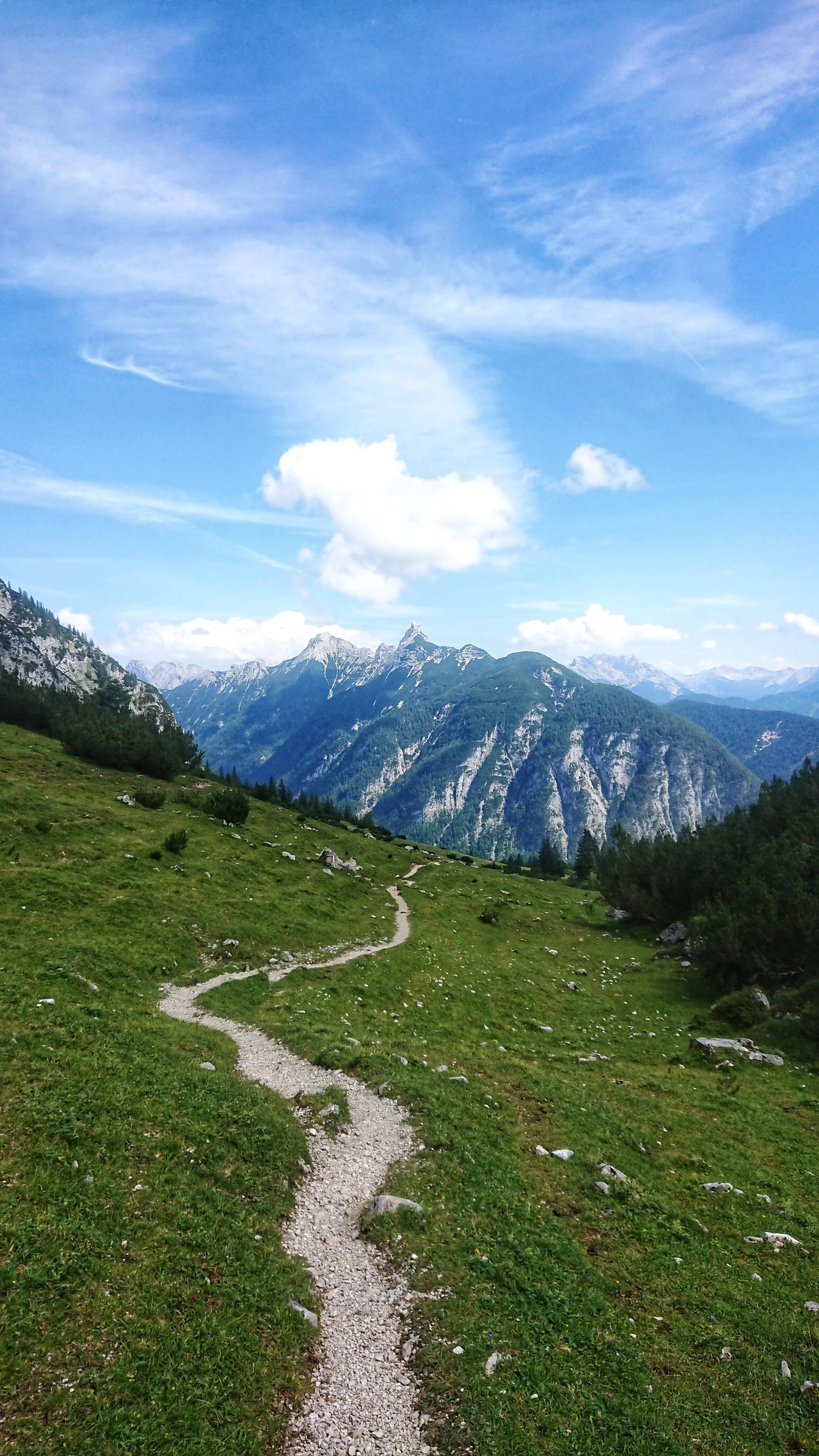
This point marks the start of our downhill into the Puittal – definitely one of the highlights of the loop. The descent to the Puitegg-Alm flows beautifully through open alpine terrain, with sweeping views of the Arnspitze group. After the Alm, the trail steepens as it winds through forest until we reach the valley floor again. At the forest edge, we pick up a wide trail heading south and gently cruise back to our starting point in Leutasch.
Pro tip: This loop – when run clockwise as described – is listed as an official FKT route on www.fastestknowntime.com. A great opportunity for competitive trail runners to test themselves against the current best times.
Photos by @bennibru